PROTECTING THE LANDS OF THE MAKALU-BARUN
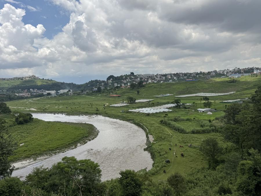
The Makalu-Barun region of northeastern Nepal, begins east of Mr. Everest and extends forty kilometers to the Arun River, one of the world's deepest river gorges. It is remote and wild, even by Nepalese standards. The nearest roadhead is a hard five-day walk, and many villagers have never been that for south. They are unfamiliar with cars, tape recorders, and cameras. Terraced fields are built by hand and tilled by ox and wooden plow. Except on mountaineering routes to the Makaly Base Camp, a foreigner is a rare sight. Hedangna, the largest village in the conservation area, is remote, physically and intellectually. Month-old newspaper occasionally arrive at the local government office, but few villagers can read them. A few villagers have radios, but even news of Kathmandu seems abstract and other worldly. One or two members of each family may take a trip south each year to get salt, to plead a case in a land dispute at the district court, or simply to see the weekly market.
Most of the time, however, most people stay in Hedangna. They are subsistence rice farmers, planting rice year after year on terraced fields built generations ago by their ancestors. Most goods in the region are obtained by barter. The population is growing. A few people migrate south, as they have for the past hundred years, to try their luck working on roads in northern India, but most simply try to get by on smaller and smaller plots of land.
The vision and initiative to protect the biological and cultural diversity of this region came from Nepalese and foreign researchers. Woodlands Mountain Institute, an American nonprofit organization, joined Nepal's Department of National Parks to design and implement the Makalu-Barun National Park and Conservation Project.
In addition to the conservation project, Nepal's largest development project to date, a major hydroelectric facility and access road for the area's eastern border has been proposed by the Nepalese government and a World Bank-lad consortium of international donors. The 150-foot-high dam is to generate electricity for export and the growing needs of the sprawling capital city of Kathmandu.
A two-year research study to create a management plan for protecting the Makalu-Barun was conducted by Nepalese scientists and social scientists, foreign consultants, and Woodlands staff. This plan recommended the creation of a 1,500-square-kilometer national park and an adjoining 830-square-kilometer conservation area. The national park, which will be on lands now used by villages for grazing and religious pilgrimages, will be managed according to a multi-use model: areas not used by villagers will be strictly protected for biological diversity; other areas will see continued traditional uses; and in still others 'ecotourism' will be promoted. In the surrounding conservation area, park staff will work to improve systems of land use, foster economic growth, and provide educational opportunities for people living in the villages. Both programs are to be implemented according to a "participatory model of land management and resource utilization."
The young men and women of the Makalu-Barun want desperately what westerners have: health, freedom to travel, and material wealth, and they are interested in the park and dam as a source of jobs that may give them these privileges. There is little garbage in any villages away from trekking routes, but those communities that support western hikers are notoriously strewn with waste. There is the feeling that waste is a sign of excess and that a little excess is what they want. Ironically, just as the value system of resource exploitation for economic development takes root, westerners are also introducing their new values of land conservation. ON the one hand villagers are told their lives are too hard, their way of life interior, while on the other they are urged to preserve their culture and lands.
The villagers of Hedangna, the largest village, have a very sophisticated understanding of the physical and spiritual work necessary for survival in this remote valley; they know that good rice harvests and healthy families require significant effort. But they lack this deep understanding when it comes to development. Most villagers have no understanding of the complexity of planning, funding, or participating in projects of this scale, nor do they have any idea of the degree to which the park; will change their lives. Until they feel that these projects directly touch on their ability to survive, it is easier, and safer, for them not to get involved. Once the government of Nepal creates a boundary. However, the boundary will not be moved. What the villagers also do not yet understand is the political and economic power behind different ways of mapping.
MAPPING THE LAND
Land rights in Makalu-Barun depend more on the relationships among the users on any given day, the time of year, and the resource in demand than they do on any rigid rules of land ownership. Like bargaining over prices in the bazaar, rights to resources are negotiated between user and owner again and again. Edges of an individual's land are more vulnerable to encroachment than the center, and rights to these lands become more flexible the farther one gets from the village. Maps illustrating these rights might be represented more clearly as a series of overlapping clouds, fading at the edges, rather than as the discreet blocks bounded by thin black lines on the conservation map.
For villagers who depend on livestock for their livelihood, the significant resource in these particular pastures is grass; the right to graze their water buffalo and cows is what they buy, lease, and sell. The area's designation as a national park and conservation land would mean to them that outsiders had defined other resource and uses, and these resources and use need different sorts of maps bounded by different sorts of lines.
MAPS AS A WAY OF KNOWING
As an outsiders, I could see neither the lines regulating rights to the grass and trees described to me by the villager, nor those marketing the boundaries shown on the national park map. All I saw were rocks and streams, juniper bushes and snow-covered peaks. The same trail could be seen as an ancient pilgrimage route to sacred lakes and peaks or as a path to be protected so that trekkers also could enjoy the spectacular mountain scenery. The different meanings and use of these bushes and peaks only began to make sense as I learned to see what the villagers or the park staff saw in the land.
By naming objects, we organize and make sense of a world that would otherwise be unknown, chaotic. Maps and boundaries, our traces on the land, are ways of illustrating the particulars of naming and knowing, ways of demonstrating spatially what we see conceptually.
Naming the objects of our places is a way of entering into relationships with those places, of making them our own, of creating a home. When we are forced to live in places according to boundaries, maps, and names that are created elsewhere, we in turn become alienated from those places. A more subtle estrangement occurs when outsiders attribute different meanings to the places where we live. This kind of "conceptual trapping," some argue, now occurs under the guise of economic development and environmental management.
When a concept is enclosed in the context of a radically alien language, something is inevitably "lost in translation." When what is lost is essential to the identity and livelihoods of a group, yet they are unable to use their native language to regain or defend it, their defenses are weakened and they become victims.
PERCEPTIONS AND USE OF THE LAND IN HEDANGNA
Each year, every household sets aside the largest, healthiest stalks of ripened rice and millet for the next year's seed. Twenty-two different species of rice and six different kinds of millet grow in the fields surrounding Hedangna. The species differ in time needed to ripen and the amount of soil, water, and light needed for optimal growth. Women, the ones who plant and transplant all of these seeds, know which species grow best in their different fields. They watch how a particular species grows in a certain field one year, and then decide what to plant there the following year.
The villagers could point to most trees in the forest, tell me their Rai and Nepali names, and whether they were used for fuel, fooder, fence posts, or timber. When I went with the women to collect stinging nettle, they would suddenly stop and pull a clump of leaves that, to me, looked like every other clump. "Vegetables" or "medicine" they would explain. We would then walk home the long way, to pass by a lapsi tree where fruit for chutney could be found.
These villagers have moved the rocks, felt the soil, and cut the trees on these lands for their entire lives. They learn the names of these objects just as we learn what a fork, a stove, and a toilet are called and how they are used. Knowing these names and uses is not a broad, general kind of knowledge applicable anywhere; villagers become less sure of things at a higher or lower elevation. The villagers are rooted in the lands that sustain them.
WAYS OF MAPPING IN THE NATIONAL PARK
The men and women in Hedangna look out at their world from their stone-and-mud hoses, from their rice fields, from their forests. Without grounding in a particular place, it is impossible for them to attach meanings and uses to those houses, fields, and forests. In turn, there is no place from which the village can be mapped completely, objectively. Mapping the village, just like understanding its history, involves looking at it from a number of different homes, collecting the stories of a lot of different storytellers.
The conservation map, on the other hand, is a series of lines laid out as a bird might see the land. There are no ridges that block other villages from view because all of the ridges can be seen equally, according to the map.
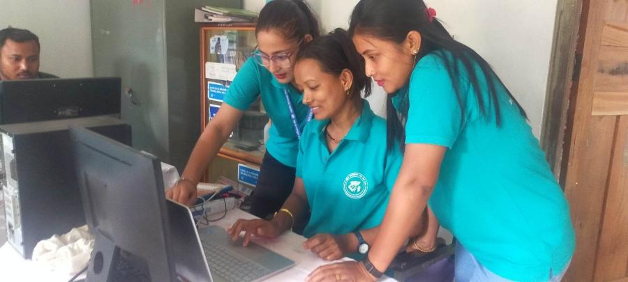
Of course the maps are not the objective, impartial accounts that their presentation implied, nor do their authors contend that they are. They were constructed by particular individuals educated to see certain things when they walked to land. The staff for the park conducted extensive research in the Makalu-Barun to make these maps and prepare the reports. They traveled throughout the villages asking questions about local land use and oral traditions, about health, forest and sacred lands. Then they returned to Kathmandu, where they consulted with own ways of naming and knowing the land, prepared their reports.
Far more research has gone into designing this project than into almost any other project in Nepal. The programs they are now beginning to implement are innovative and important. Makalu-Barun staff recognize the complexity of their task and intend to modify plans and methods as they learn from experience. Still, at this time, the villagers see the lines on the map and the project's proposals as non-negotiable, as decisions that have already been finalized.
In other areas of the world where villages are well organized and understand more about the larger context in which they live, they might have demanded a greater role in the project even before being encouraged and trained to do so by park staff. But villagers in Hedangna have a strong sense of inferiority. One of the few villagers who has been educated in Kathmandu and who is now a teacher in the village school spoke despairingly of their farming practices, their homes, their behavior and attitudes. "We are backward," he said. "We need development so that we can't be `modern."
One of the stated objectives of the park is to create a greater awareness among villagers of the importance of their cultural heritage. The project will support traditional land uses, protect cultural sites, and document oral traditions. Even so, from the villagers' point of view, it took educated outsiders to design the project, not their traditional healers, farmers, and Buddhist lamas.
HEIRS TO THE LAND
The debate about the future of the Makalu-Barun is similar to that facing lands in many parts of the world. These debates are often presented as conflicts between environmental preservation and economic development. The real issue in these conflicts, though, is the question of how to create livable communities, places where people want to stay because they believe they can live good lives in these places. Ultimately what is at stake in these areas, then, is control: who will decide the meanings and boundaries in these communities, and thus be the heirs to these lands. Outsiders can play an essential role in influencing this future. Yet, more important is the faith of community members in their ability to participate in the creation of that future. Outsiders might begin by providing villagers with the told and the guidance needed for them to map their own lands in their own ways. This process would enable local people to acquire the skills needed to present their ideas about their lands alongside those of economists, lawyers, anthropologists, and activists. It would enable villagers to begin to understand what is at stake in the debate over their lands, and whether and how they want to participate in this debate.
UNMAPPING THE LAND
In speaking of culture and agriculture, Wendell Berry writes:
"An enduring agriculture must never cease to consider and respect and preserve wildness. The farm can exist only within the wilderness of mystery and natural force. And if the farm is to last and remain in health, the wilderness must survive within the farm. That is what agricultural fertility is: the survival of natural process in the human order."
Berry argues that farming will be healthy and enduring only as long as there is room for what is undomesticated and uncultivated. If naming is an act of domesticating a previously wild object, Berry's comment in turn means accepting that there are limits to what we can know and name. Neil Evernden writes, "The more we come to dwell in an explained world, a world of uniformity and regularity, a world without the possibility of miracles, the less we are able to encounter anything but ourselves." Different peoples have different ways of knowing and cultivating the land. What is named for a logger in Maine or a shaman in Nepal may be left unnamed by a lawyer in Boston or an economist in Kathmandu. If the economists and lawyers decide that they are the only ones capable of making decisions about the future of these lands, there will be no reason for the villagers to retain their own systems of naming.
At a 1989 environmental conference Oren Lyons, faithkeepers of the Iroquois, warned the audience of the effect that pursuing such a path had had in the past. He said: You thought you knew all the answers, thought you could solve all the problems of the world. You didn't need us, so you set us up on reservations where we could be kept quiet. And now, suddenly, you realize that maybe we had a few good ideas, that maybe we were on to something in the way we thought about nature. And now you come searching us out, asking. "What was it you said about the earth? What exactly are your religious beliefs?' And we sat, `We don't know. We're all Baptists now."
Article copyright Cultural Survival, Inc.