Mosquitia is one of the last great wilderness regions remaining in Central America. The name Mosquitia is a historic term used to refer to an isolated region of land located in eastern Nicarague and Honduras. While variously defined, the region holds some cultural and ecological integrity from the Rio Tinto in Honduras to the Rio San Juan in Nicaragua. The well-known eastern part of the region, an area of flat, pine-covered savannas with a network of lagoons and swamps along the Caribbean coast, is the home of the familiar Miskito (sometimes spelled Miskitu) Indians. Lesser known western Mosquitia's hilly uplands, covered by one of Central America's last stands of tropical rain forest, are inhabited by one of the region's least known populations, the Sumu Indians.
One of Central America's smaller indigenous populations, the Sumu are also one of its most endangered. Out of a population of around 10,000, most used to live in about 38 villages in the Atlantic province of Zelaya, within the Nicaraguan Mosquitia. However, 10 years of the contra-Sandinista war has disrupted the traditional Sumu lifestyle, and today only a few of their historic village remain (Americas Watch 1987). For the past decade most of the Sumu have been living in temporary resettlement campus within Nicaragua or in the insecure refugee villages within Honduras. Although recent political changes in Nicaragua now offer the Indians a real chance to return to their homelands, the years of exile and forced relocation have left deep scars on their ethnic identity and cohesion. By the end of 1987, Americas Watch (1987:15) was reporting that 900-1,000 of the Sumu had been repatriated and about 7,000-8,000 were believed to the living in Nicaragua, with some 1,800-2,000 remaining in Honduras. Today, the number of refugees in Honduras has been greatly reduced, and while accurate estimates are unavailable, probably fewer than 500 Nicaraguan Sumus remain in the Honduran Mosquitia borderlands.
The Honduran Sumu
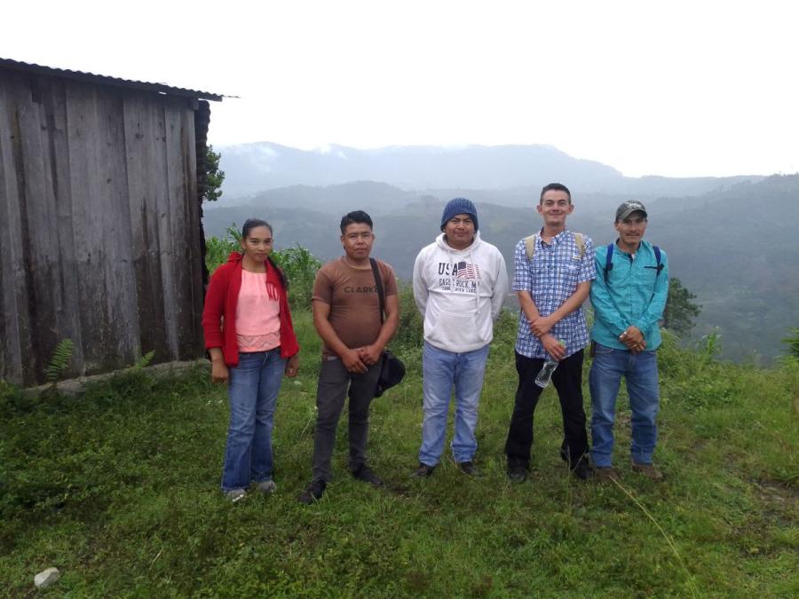
Only a small group of Sumu - those isolated in the remote uplands of the Rio Patuca in the Honduran sector of the Mosquitia - has remained largely unaffected by political events: the Tawahka Sumu, one of a number of Sumu linguistic subgroups (von Houwald 1980). For centuries, these Honduran Tawahka Sumus have been separated from the main center of their population. Today they survive as a group of around 700, in seven settlements along the banks of the middle Patuca around the mouth of the Rio Wampu. Their territory lies within the last stand of tropical rain forest in Honduras, a sanctuary of sorts that has enabled them to continue their traditional way of life in isolation from the rest of the country's economic and political developments. They remain largely subsistence-oriented farmers who depend heavily on hunting, fishing, and gathering. Even now, they are only minimally involved in cash economies, primarily through selling some grain crops and working placer gold deposits far from their villages, in the headwaters of the Rio Patuca.
Until the 1980s, Tawahka Sumu's lands and Mosquitia's forests in general had been almost totally removed from the nation's pressures of economic development (Brunt 1981). Over the last decade, however, the forests that once limited access into the region have become one of the prime attractions for outsiders.
Colonization Versus Indian Land use
Ladino (non-India) hunters, gold panners, and, more significantly, lumber merchants initially opened up access routes to the hitherto virgin regions of western Mosquitia. These routes now provide access for landless peasants who lay claim to what are legally defined as "national lands" - that is, lands belonging to the state. Through slash-and-burn agriculture the immigrants progressively clear the forest, opening them up for cattle ranchers, who consolidate these peasant's landholdings, planting pasture grasses and introducing cattle herds. This form of land use dramatically and permanently changes the cultural landscape. Each group successively contributes to the demise of the area's fragile ecosystems by seeking to use the land for purposes that are incompatible with its ecological conditions. Most soils beneath Mosquitia's exuberant forest foliage are extremely poor in nutrients and acidic in composition, making them unsuitable for large-scale agriculture or cattle breeding operations (Cohdefor 1989:5). Land-use studies in the region recommend forestry as the main form of land use for the area (Simmons 1969, in Brunt 1981:86-87).
Ironically, most peasant migrants are aware of the damage they inflict on the land; indeed, many have actually moved into the region as a result of the desertification of their farmlands in other parts of the country. Poverty, they claim, is the main motive for practicing slash-and-burn agriculture, which requires a minimum input of energy to produce quick-growing, bountiful crops. There are many other motives, however: a lack of legal land tenure, limited access to agricultural credits, ignorance of alternative farming methods, and, in some cases, simple greed. Whatever the reasons, the arrival of the colonists, coupled with the relocation of Nicaraguan refugees, has placed greater pressures on the Tawahka's natural resources, disrupting the delicate balance between their method of land use and the forest environment. Increasingly, the necessities of life - game animals, fish, lumber, thatch, construction materials, firewood, and good farmlands - are located farther and farther from their traditional settlements.
The colonization front penetrates Mosquitia from the west like a plough, pushing eastward and leaving fallen forest in its wake. Moving down the main tributary streams of the upper and middle Rio Patuca, the front has entered the region along the Guayambre, Guayape, Patuca, Cuyamel, and Wampu rivers, and now threatens the Tawahka's ancestral lands. Gold prospectors, cattle barons, and agricultural peasants now compete for the forests and resources that have, for centuries, been under the stewardship of the Indians. In 1989, for the first time, colonists penetrated the land used by the Tawahka Sumu communities settled along the Rio Patuca. With no legal permission, they claimed approximately 7,000 manzanas (one hectare equals 1.434 manzanas) of land that had historically belonged to the Indians (Cahdea 1989:7; INA 1989:8-3). These lands were used by the Sumu for hunting and collecting, or were under secondary regrowth fallow management.
Indian lands not under active cultivation or fallow management or those used for hunting, fishing, or gathering are often perceived by the ladino population as being idle and as such are considered easy targets for expropriation. The lack of land tenure rights encourages the ladino colonists to grab and exploit tribal territories. At the same time, the Tawahka Sumu do not, strictly speaking, have legal rights over their lands, although they hold weak claims due to their ancestral occupation of the region. Furthermore, Article 346 of Honduras' Constitution states that the government should project indigenous populations and the forests that may exit on their lands. However, the Indians' isolation and the government's inertia have contributed to neglect of both of these options. The ladino colonists therefore find it easy to argue that they are putting the "idle" land to agricultural use and hence have more right to it than the Indians.
The Honduran Sumu are also treated as second-class citizens, making them prone to being overrun by the astute and powerful ladino immigrants. They are fighting from a very weak position: a minority Indian group within an indigenous minority at the national level. The loss of their lands could wipe out their culture in Honduras within a matter of years, forcing, at best, their assimilation and dependence on the immigrant ladino society or, at worst, their genocide.
Legalizing the Land
In 1988, Mopawi (an acronym formed from the Miskito words "Mosquitia Pawisa," meaning "Development of the Mosquitia"), a nonprofit, nonsectarian, apolitical development agency based in the Mosquitia, initiated a land legalization program in the region (partially financed by Cultural Survival and World Neighbors). The program aims to "enable the indigenous communities in the Mosquitia to procure an appropriate and legalized land tenure system" (Mopawi 1989:6). The program concentrates on creating an awareness among the Indians of the issues and consequences resulting from ladino migration into the region, focusing on their need to legalize their historic rights to land as well as providing channels for their responses. Mopawi aims to help the Indians establish contacts with government officials and to cover some of the financial costs.
As a result of the program's efforts to marshal concerned government ministries and agencies as well as Indian organizations of the Mosquitia, officials from the National Agrarian Institute (INA) visited the Mosquitia in April 1989. In a meeting with Indian delegates and local authorities, INA officials agreed to set up a working commission that would draft an agreement on how to legalize the Indians' claims to land. The commission, made up of representatives from all concerned government agencies and by indigenous authorities, met in June 1989 and drafted and signed a formal Convenio de legalization de tierras.
The convenio was initially based on the experience that INA has had in the rest of the country. As part of a long-established land titling program, individual families are given legal title over 5 hectares of land under the condition that it be used for agricultural purposes. From the outset, however, the Indians did not accept such a concept since their methods of land use involve large expanses of forest not used for agricultural purposes. This idea was somewhat alien to INA representatives, who saw the issue in terms of the nation's Agrarian Reform Law, which focuses on legalizing land tenure as a prerequisite for increasing the country's agricultural output.
A compromise was reached, however, by all parties agreeing to issue provisional guarantees to "community lands" as part of the convenio. Each community's area would be defined based on the villagers' own population census and their own attempt at mapping the lands that they claimed. This information would be used to provide each indigenous community with a provisional guarantee to a specific plot of land within which they could administer land use based on their own traditional methods. In signing the convenio, the Indians accepted the provision that they would protect and conserve the natural resources of the area while respecting the general laws of the state. In return, INA would initiate litigation to grant legal property rights. The convenio applies to all communities within the Department of Gracias a Dios and it defines a regional process that was explicitly supposed to begin with the Tawahka Sumu villages along the Rio Patuca, with lands that were considered in most urgent need of protection.
The Tawahka Sumu wasted no time in initiating the provisional guarantee process. Already aware of the impending threat of ladino migration. FITH (Federcion Indigena Tawahka de Honduras, a fledgling Tawahka Sumu political organization formed in 1987) representatives had initiated contact with INA during their visit to Mosquitia in April 1989. On that occasion, they protested the colonists' invasion and successfully requested that INA take actions to expel them. Shortly afterwards, with the technical assistance from Mopawi, FITH mobilized its people and succeeded in getting the largest Tawahka settlement of Krausirpe (population approximately 390) to conduct its own census and sketch a map to help define its territory. INA then interpolated this data and granted the community a provisional guarantee to an area of 7,500 hectares in November 1989 (INA Resolucion No. 194-89).
Reappraising Land Use
Recent field work has shown that when considering the broader social use of the paisaje cultural ("cultural landscape") of the Tawahka Sumu along the Rio Patuca, INA's community-based" approach to provisional land guarantees falls short. At first sight, the area allocated to the Krausirpe villagers might seem large or even generous on the part of the government authorities. Indeed, it probably should be considered so. But the national authorities as well as the resources. Field studies have shown that looking at the Indians' broader use of the land reveals the guarantee to be a gross underestimation of the area actually used by the Krausirpe villagers.
This point becomes particularly important considering that the Sumu, in comparison to other Indian populations in Central America, are not heavily involved in agricultural market production. A large part of their livelihood depends on their use of the forest, from where they obtain fresh meat, wild plants, medicinal herbs, house construction materials, wood for making canoes, and a wide variety of other products. Krausirpe villagers exploit lands that extend far beyond the limits of the INA provisional guarantee.
A further point highlighted by the field study is the fact that it is not possible to segregate the land used by individual communities, as proposed in the convenio. The Patuca Tawahka villages have overlapping areas of resource use that they have traditionally exploited compatibly amongst themselves. Areas of nonagricultural resource exploitation cannot be neatly separated among communities for the purpose of INA's community-based approach to land legalization. In other words, villagers from all seven settlements hunt, fish, and gather in many of the same rivers and forest areas, even though these may be at considerable distances from their actual villages. The Tawahka are becoming aware of this fact through efforts by Mopawi and other concerned parties, and hence have temporarily halted their efforts to further implement the convenio as it stands.
The Future
The Tawahka Sumu have become aware that their land legalization efforts need to take on a regional perspective. All parties involved in the process realize that their efforts need to pay more detailed attention to the real area of land used by the Indians to incorporate the extensive overlap of land use between different communities. Although the convenio represents an unprecedented step in the fight for legal land rights for the Honduran Mosquitia's indigenous population, it will not provide satisfactory results in the face of the advancing colonization front. Under the existing convenio the legalized plots of Indian land would become isolated islands of agricultural land with just a little forest, meaning that individual village lands would become surrounded by a sea of deforestation and cattle ranches and subject to the influences of the surrounding ladino culture. The Tawahka Sumu are currently reevaluating and, more importantly, mapping their broader "social use" of land in a bid to restructure their land legalization efforts on a more appropriate and better defined basis of information.
Through INA, the country of Honduras should be applauded for its efforts in seeking to legalize the Mosquitia Indians' historic claims to land. The same cannot be said for many of the nations facing similar problems. INA's community-based approach to land legalization should not be viewed as a political attempt to cheat the Indians out of their lands. Rather, it must be realized that INA has tried to adapt a land tenure structure used among the rest of the nation's peasant farmers to the very different reality of land use employed by the Indians. Considering that the government has had no previous experience in this particular field, its initiatives are particularly bold and only need to be refined as more information becomes available.
The new government administration ushered in by the November 1989 elections has brought with it new people at the head of INA and other resource agencies, new thinkers who are very open to discussing the idea of carrying out land legalization on a regional basis. Moves are already under way to draw up a new and more appropriate convenio. The current wave of environmental concern that is sweeping Honduras provides an opportune moment for the idea of legalizing regions of Indian territory; this would significantly contribute to the nation's expressed desire to conserve its remaining areas of rain forest.
The lack of land tenure to secure Indian territories against outside intervention encourages incompatible and ecologically destructive use of these lands by outsiders with different economic imperatives. The Tawahka Sumu of Honduras have exploited the rain-forest uplands along the middle Rio Patuca for centuries without damaging the region's ecology or natural habitats. The land legalization convenio between the Indians of Mosquitia and INA is the first of its kind. All parties involved apparently agree that the native peoples have rights to their ancestral territories. The need now is for the government and Indians alike to reevaluate the "social use" of Indian lands in the region. The process is already under way among the Tawahka Sumu, and some authorities suggest it might be appropriate to define a broad regional boundary around their land. By working together on the land legalization issue, the Indians and the state may reach two very important goals common to both: to preserve the Mosquitia's cultural Indian heritage and to conserve the nation's last stand of rain forest, while simultaneously allowing it to be exploited rationally and to support sustainable ecologically sound economic activities.
Notes
These organizations included INA, Cohdefor, Secplan, local government, municipal authorities Mopawi SATAP, MASTA FITH, and Fetriph.
At the same time, similar guarantees were given to two other villages in Mosquitia, signifying an approximate total of 19,000 hectares in all being handed over to the Indians of the Mosquitia in 1989. The Miskito village Pimienta, just below Krausirpe along the Rio Patuca, was awarded a provisional guarantee of approximately 7,500 hectares, and Las Marias, a Pech (Paya) village along the Rio Platano, was awarded 3,665 hectares.
References
Americas Watch
1987 The Sumus in Nicaragua: An Endangered People, New York and Washington, DC: Americas Watch.
Brunt, N.A., ed.
1981 La Mosquitia, Honduras: Resources and Development. Volume One: The Environment, Surbiton, England: Land Resource Development Center (Overseas Development Administration).
Cahdea (Consejo Asesor Hondureno para el Desarrollo de las Etnias Autoctonas)
1989 Terratenientes ladinos invaden tierras Tawahkas. Presencia Etnica 1:7.
Cohdefor (Corporation Hondurena para el Desarrollo Forestal)
1989 Documento de proyecto: Desarrollo forestal de la Mosquitia. Unpublished document, project proposal by Freditanstalt fur Wiederaufbau, Germany.
INA (Instituto Nacional Agrario)
1989 Tierras y bosques donde estan asentadas comunidades indigenas deben respetarse: Podia recurrise a Fuerzas Armadas para establecer sus derechos. Informa Instituto Nacional Agrario 4:2-3.
Mopawi (Mosquitia Pawisa)
1989 MOPAWI (Mosquitia Pawisa): Annual Report 1988.
von Houwald, G.
1980 Diccionario Espanol-Sumu y Sumu-Espanol. Managua, Nicaragua: Ministerio de Education (reimpreso en 1988 por Mopawi, Tegucigalpa).
Article copyright Cultural Survival, Inc.